Natural Earth
Classification |
Pseudo cylindrical |
Available forms |
Forward and inverse, spherical projection |
Defined area |
Global |
Alias |
natearth |
Domain |
2D |
Input type |
Geodetic coordinates |
Output type |
Projected coordinates |
proj-string: +proj=natearth
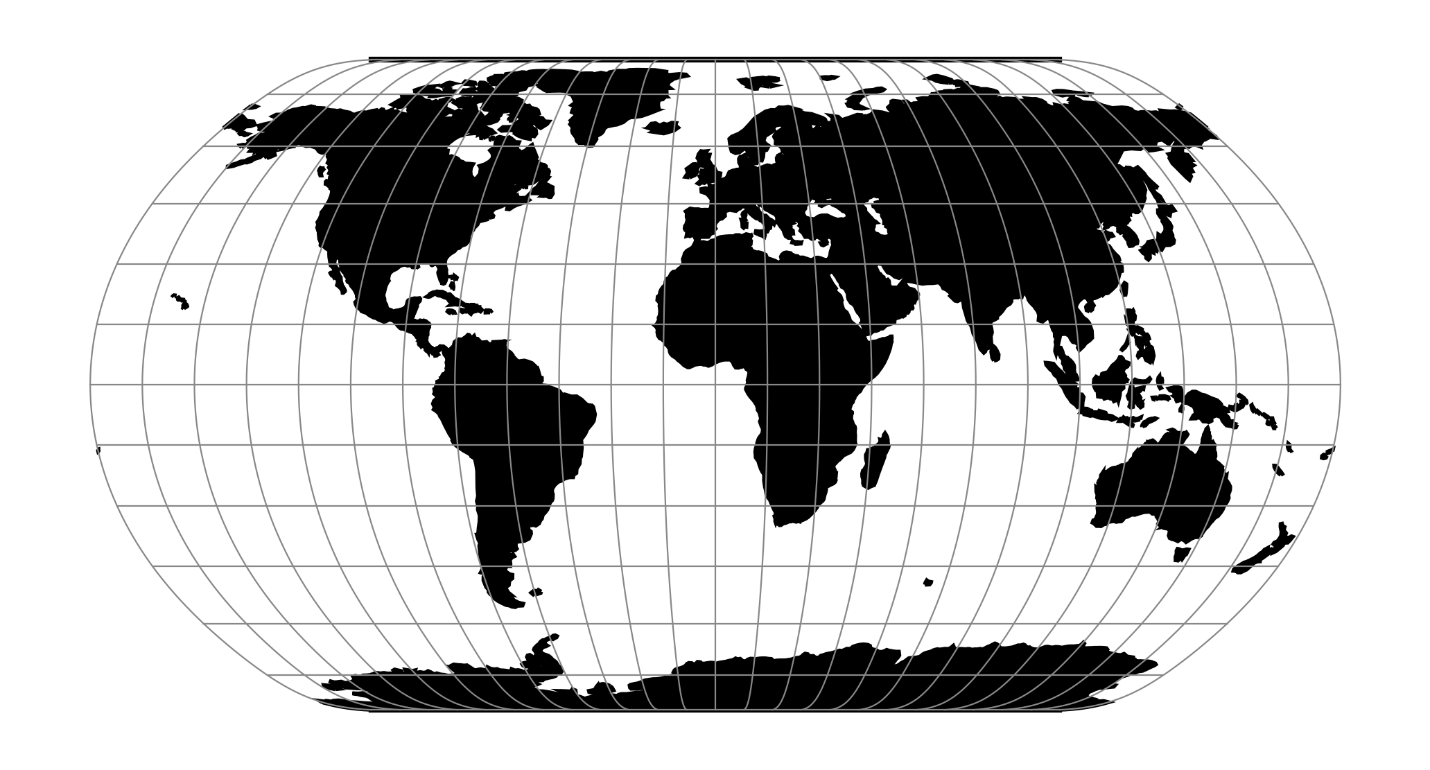
The Natural Earth projection is intended for making world maps. A distinguishing trait is its slightly rounded corners fashioned to emulate the spherical shape of Earth. The meridians (except for the central meridian) bend acutely inward as they approach the pole lines, giving the projection a hint of three-dimensionality. This bending also suggests that the meridians converge at the poles instead of truncating at the top and bottom edges. The distortion characteristics of the Natural Earth projection compare favorably to other world map projections.
Usage
The Natural Earth projection has no special options so usage is simple. Here is an example of an inverse projection on a sphere with a radius of 7500 m:
$ echo 3500 -8000 | proj -I +proj=natearth +a=7500
37d54'6.091"E  61d23'4.582"S
Parameters
Note
All parameters for the projection are optional.
- +lon_0=<value>
Longitude of projection center.
Defaults to 0.0.
Note
The default convention is to interpret this value as decimal degrees. To specify radians instead, follow the value with the "r" character.
Example: +lon_0=1.570796r
See Projection Units for more information.
- +R=<value>
Radius of the sphere, given in meters. If used in conjunction with
+ellps,+Rtakes precedence.See Ellipsoid size parameters for more information.
- +x_0=<value>
False easting.
Defaults to 0.0.
- +y_0=<value>
False northing.
Defaults to 0.0.